Mapping and Inspections
Challenges We Help Address
Many sites and structures are difficult, time-consuming, or unsafe to assess from the ground alone. Aerial mapping and inspection provide a safer, more efficient way to understand conditions and monitor change over time.
Common challenges we help support include:
Evaluating large or complex sites efficiently
Inspecting roofs, structures, or elevated features without climbing
Documenting construction or development progress
Gaining a clear overview of facilities or infrastructure
Creating visual records for inventorying, planning, reporting, or assessment
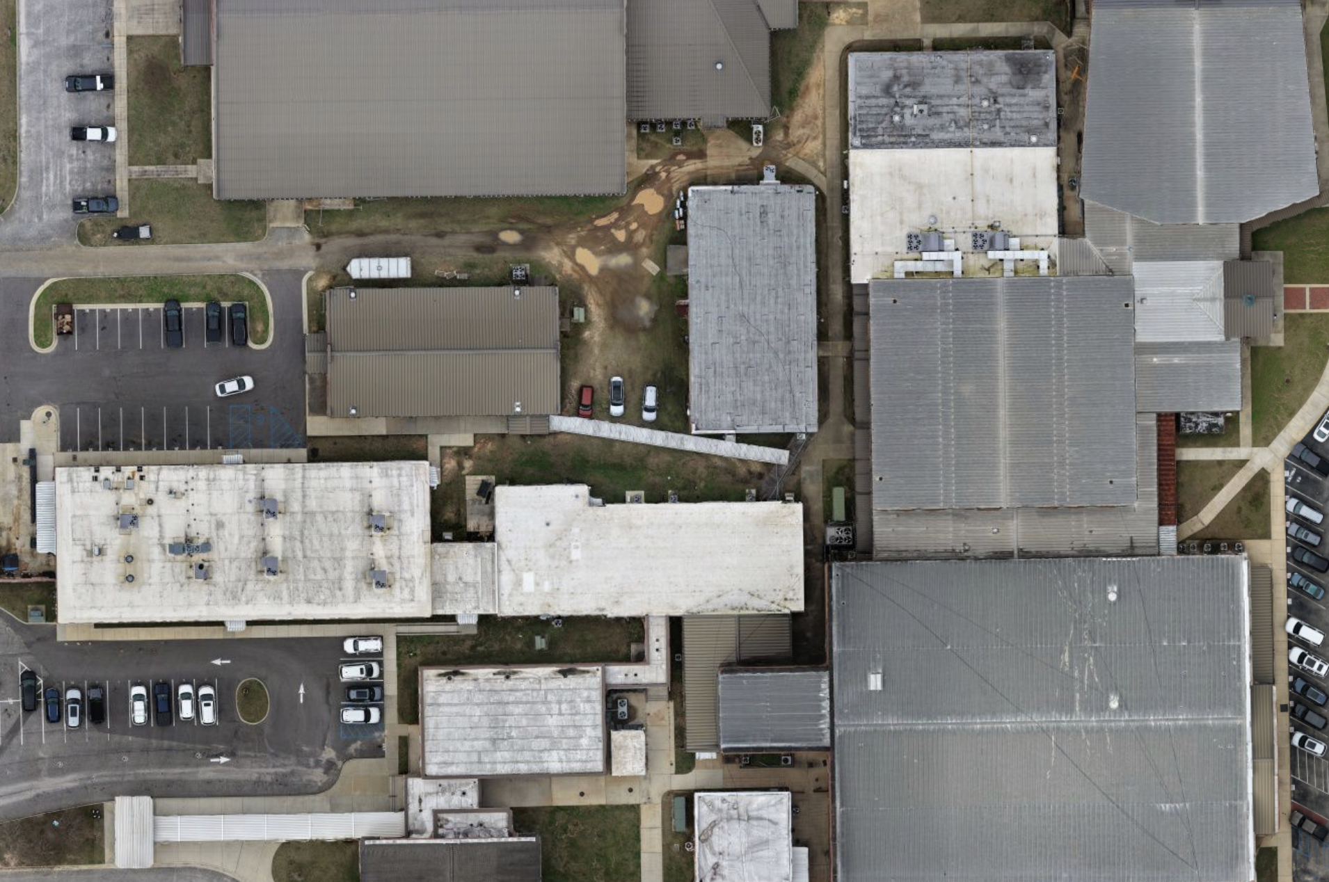
By capturing high-resolution aerial data from above, we help clients gain a clear understanding of site conditions, structures, and infrastructure without placing personnel at risk.
Our mapping and inspection services focus on accuracy, safety, and clarity—delivering visuals and data that support informed decisions across construction, utilities, land management, and infrastructure projects.
Our Mapping & Inspection Services
Each mapping or inspection mission is planned around the site, scope, and purpose of the project. Services may include:
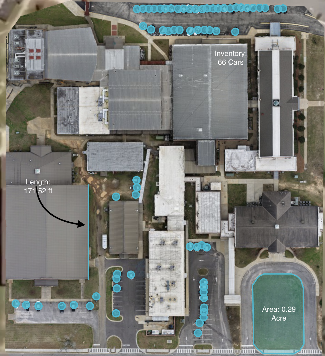
Orthomosaic mapping for land, sites, and facilities
High-resolution, measurable aerial maps that provide an accurate overview of site layout and features.Construction and development documentation
Capturing consistent aerial imagery to track progress, site changes, stock, and overall development conditions.Roof and structure inspections
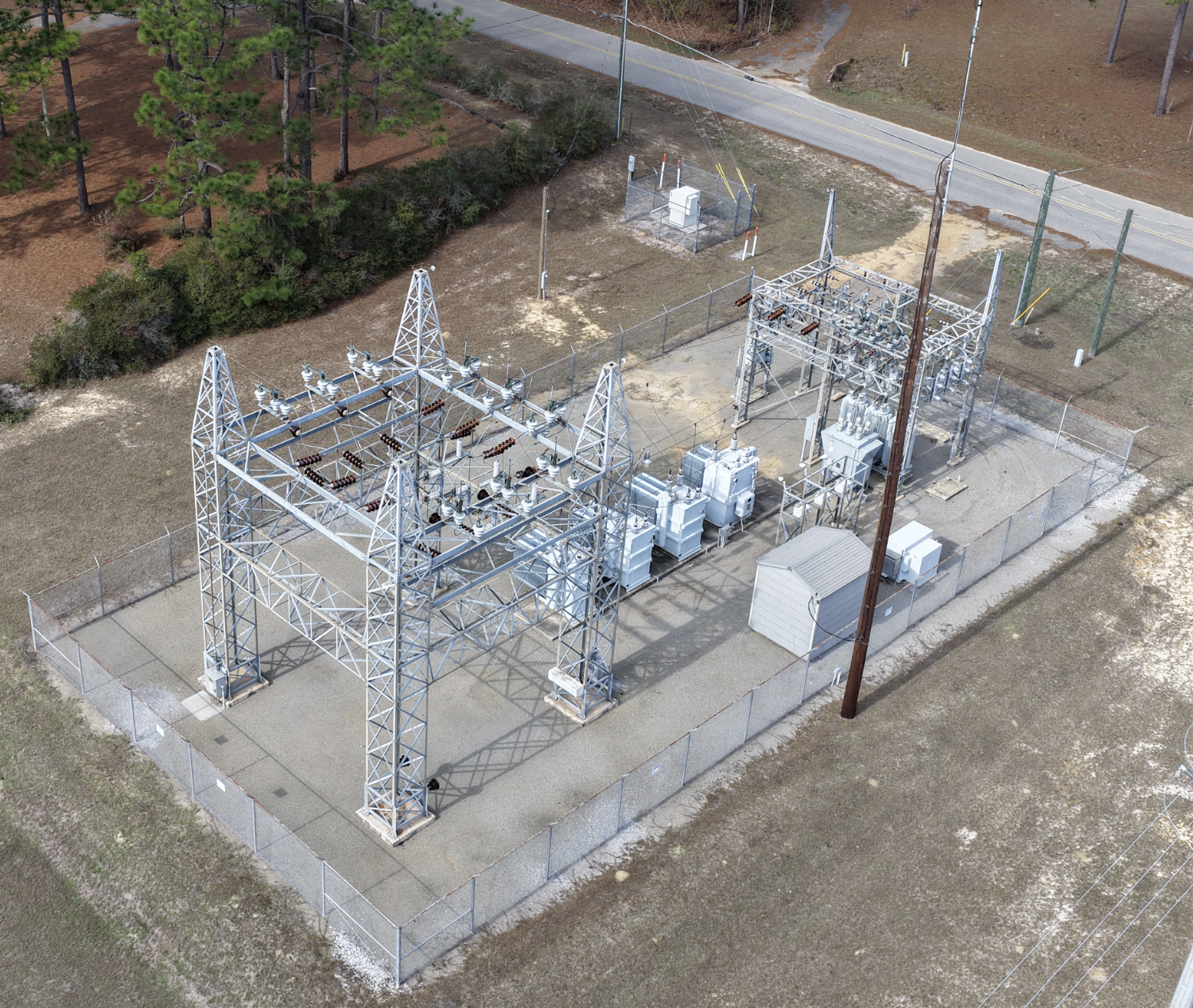
Visual assessment of roofs and elevated structures without the need for ladders or lifts.Infrastructure and utility inspection workflows
Supporting visual inspection of facilities, access areas, and infrastructure components.Site condition imagery for planning and evaluation
Providing clear visuals to support maintenance planning, assessments, and decision-making.
How the Process Works
Our mapping and inspection workflow is straightforward and safety-focused:
Initial discussion to understand site conditions and project goals
Site review, airspace evaluation, and flight planning
Aerial data collection conducted under appropriate conditions
Data processing and quality review
Delivery of clear visuals and organized outputs to support decision-making
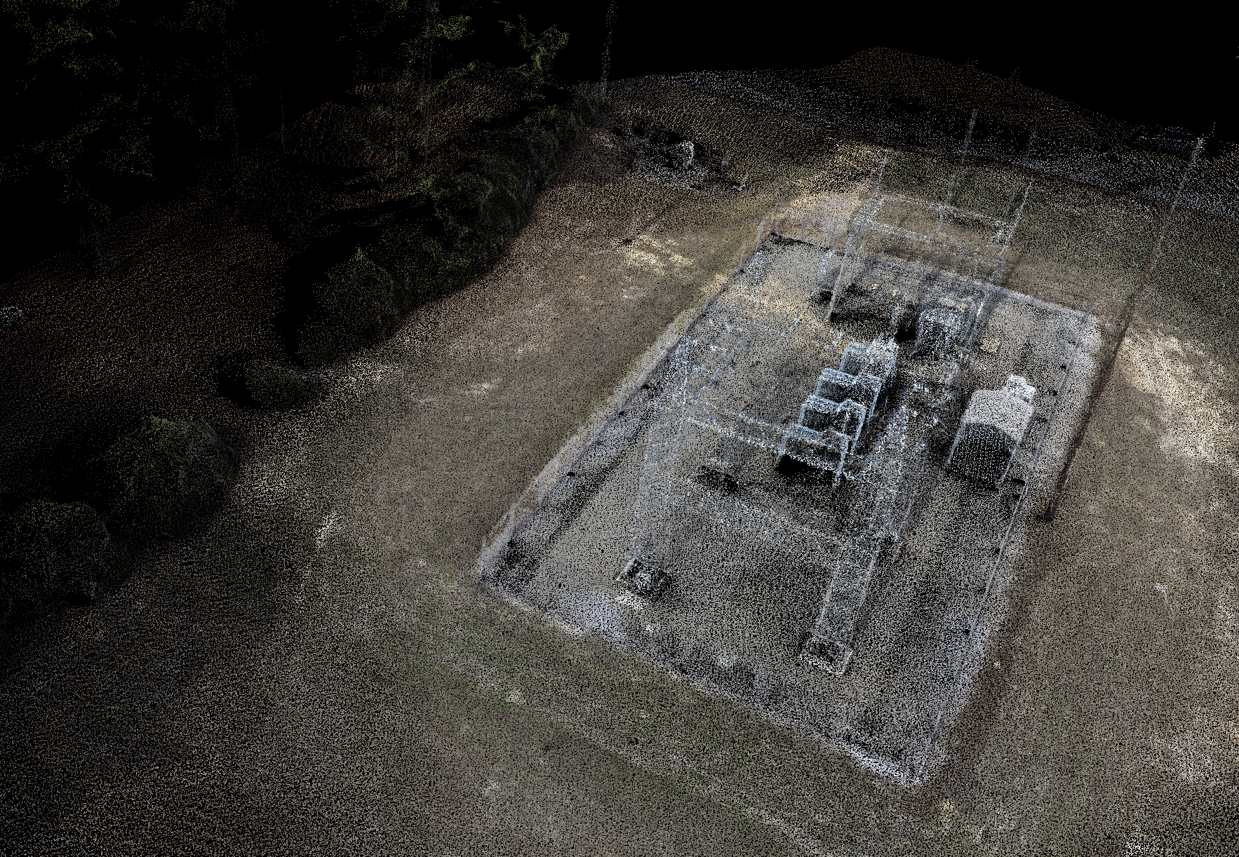
Example point cloud generated from aerial data, illustrating site geometry and structure detail. ( Each point (pixel) consists of unique photographic, lidar, elevation, and GPS Data )Why Use Aerial Mapping & Inspection?
Aerial mapping and inspection allow for safer site assessment, improved visibility, and efficient documentation. By reducing the need for physical access to difficult or elevated areas, aerial data helps minimize risk while providing a broader, more complete perspective of site conditions.
This approach supports better planning, monitoring, and communication across projects.
Get in Touch
Whether you’re evaluating land, planning a project, inspecting a site or structure, reducing inspection liabilities, or exploring how aerial data can support your work, Cornerstone Aerial Solutions is here to help. We take the time to understand your goals and provide clear, reliable insight you can trust.
Reach out to start a conversation, request a quote, or learn more about how our aerial solutions can support informed decision-making.