Elevating Agriculture from the Ground Up
By capturing high-resolution aerial imagery and vegetation data, we offer a clearer, field-wide perspective that supports informed decisions throughout the growing season.
How Aerial Imagery Supports Agriculture
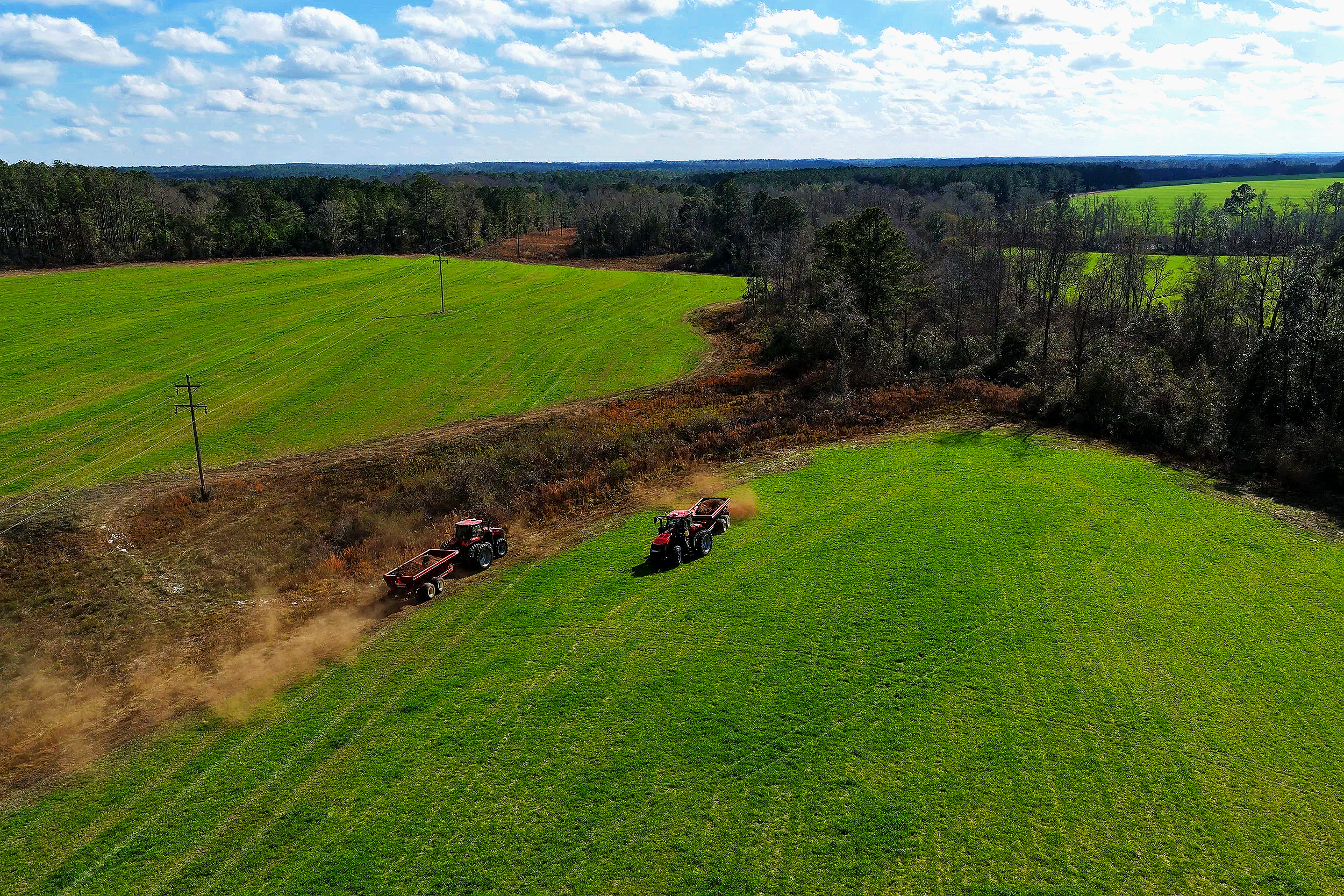
Managing agricultural land often requires timely awareness of conditions across large or uneven areas. RGB aerial imagery provides consistent, repeatable views that help reveal visible differences in crop development and field conditions.
Common applications include:
Identifying visible variability in crop growth and plant vigor
Highlighting areas that differ from surrounding field conditions
Understanding drainage patterns, low spots, and water movement
Gaining a clear overview of large or hard-to-access acreage
Documenting field conditions over time for planning and reference
Agricultural Aerial Services
Each agricultural flight is planned based on field conditions, crop type, and project objectives. Services may include:
Field and acreage overview mapping
High-resolution aerial imagery providing a complete view of field layout, boundaries, and surface features.RGB-based plant health and crop condition analysis
Visual assessment of crop variability and development patterns to help guide closer ground inspection.Drainage and erosion visualization
Identifying terrain features, low areas, and water movement patterns that influence field performance.Seasonal field documentation
Capturing consistent aerial views to track changes across planting, growth, and harvest stages.Land condition imagery for planning and assessment
Providing clear, up-to-date visuals to support land management decisions.
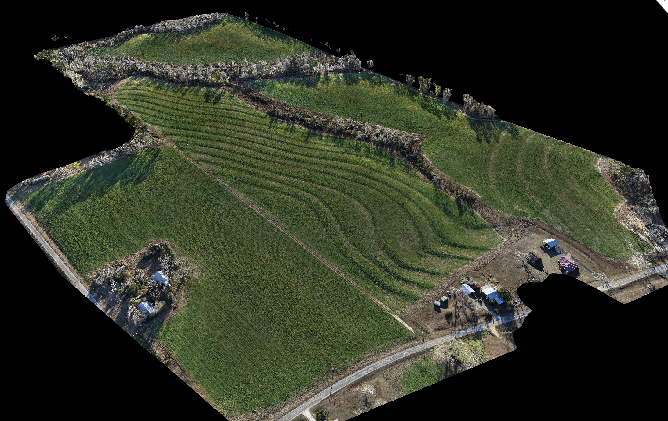
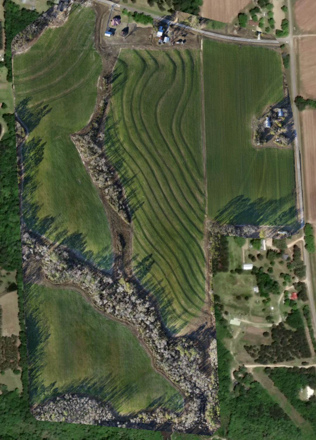
High-resolution orthomosaic imagery providing a clear overview of field layout and features.
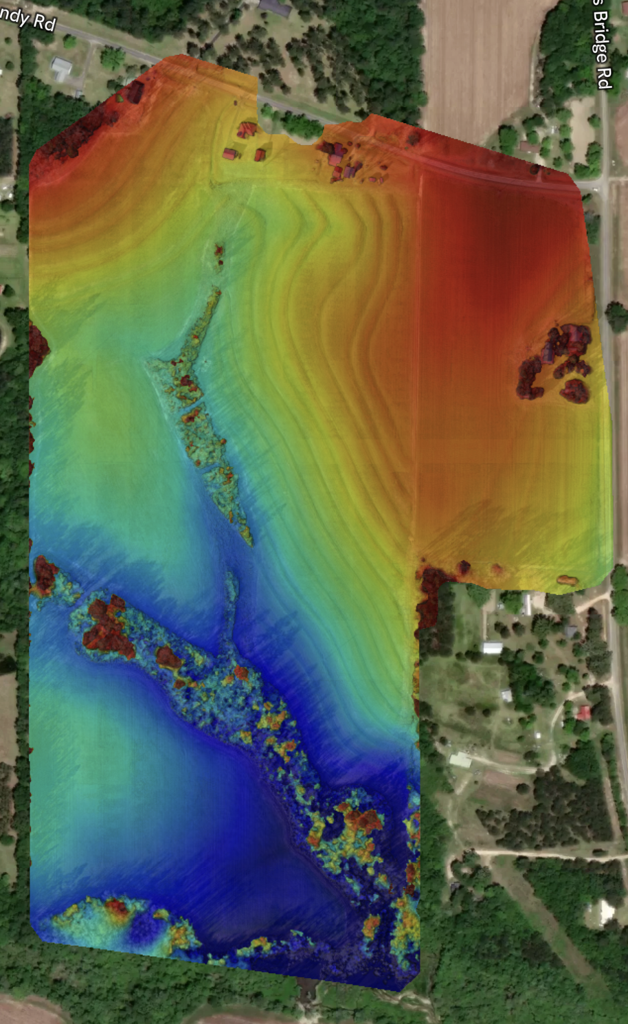
Elevation surface visualization highlighting terrain variation and drainage patterns across the site.
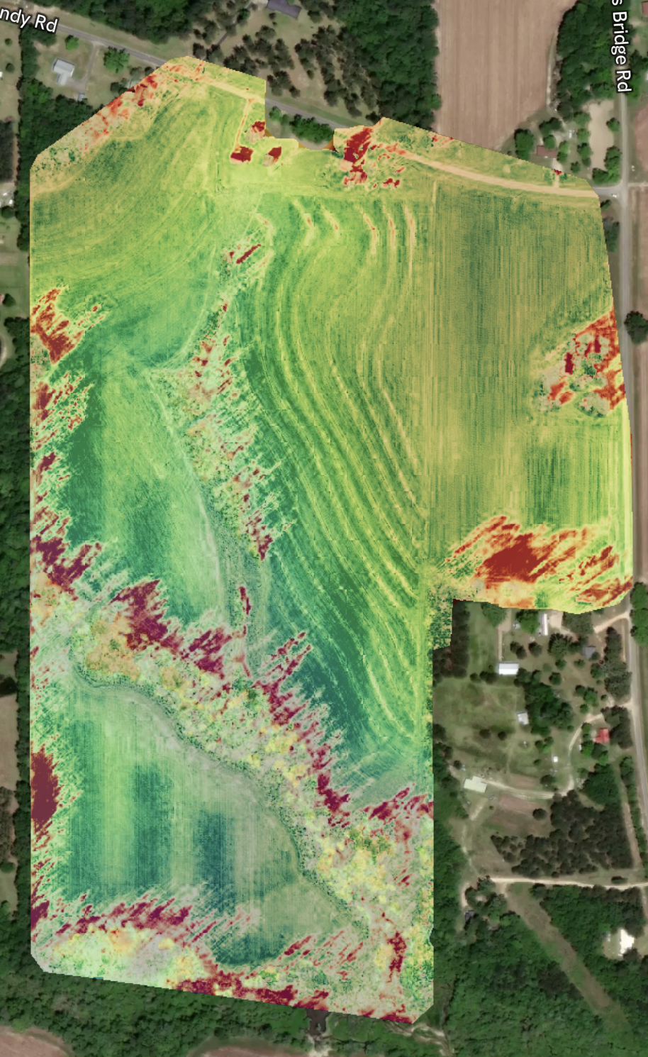
Vegetation index imagery illustrating variability in crop health and plant vigor.
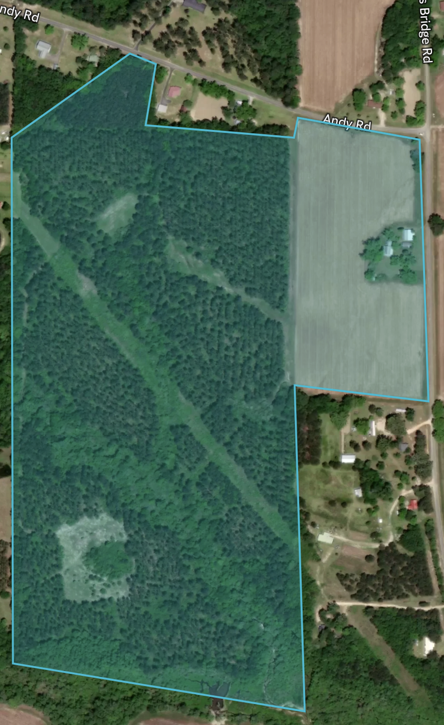
Mapped property and field boundaries overlaid on aerial imagery for updated land evaluation and planning. (Google Maps Old)
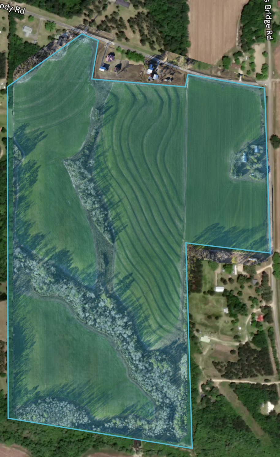
Orthomosaic imagery showing field structure, contouring, and surface features at full resolution. (Updated "Satellite" Imagery)
Blended imagery of high resolution orthomosaic mapping to update "Satellite" boundary images.
Get in Touch
Whether you’re evaluating land, planning a project, inspecting a site or structure, reducing inspection liabilities, or exploring how aerial data can support your work, Cornerstone Aerial Solutions is here to help. We take the time to understand your goals and provide clear, reliable insight you can trust.
Reach out to start a conversation, request a quote, or learn more about how our aerial solutions can support informed decision-making.